
Council is responsible for managing a wide range of public assets, from parks and sporting fields to roads, drainage corridors and former landfill sites.
Many of these assets are located on or near land that can change over time due to ground movement, rainfall, erosion or historical land use.
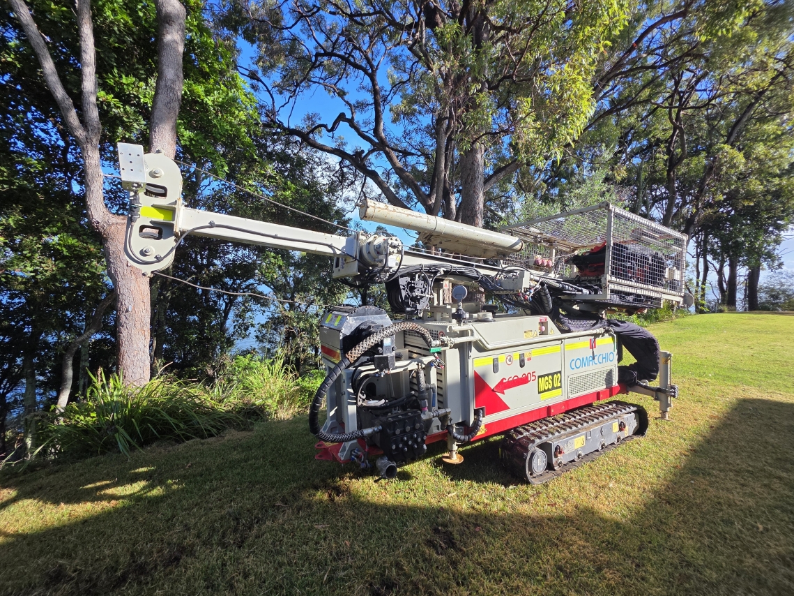
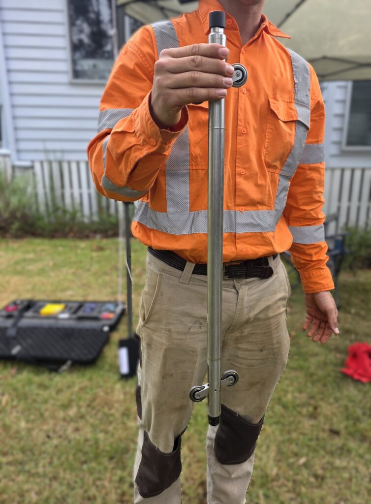
One of the main ways Council keeps an eye on these risks is by using a device called an inclinometer. This is placed into the ground through a narrow borehole that has been drilled, often to a depth of approximately 15m or more. The borehole is safely sealed and left in place.
Council officers return from time to time to take readings, which help them understand whether there is any movement happening below the ground.
Inclinometers can detect very small shifts in soil or rock layers over time which may be invisible at the surface but can signal deeper instability that, if left unmanaged, could affect public safety, infrastructure or the environment.
They are commonly installed in areas where land stability is critical. This includes embankments, slopes, retaining structures, drainage corridors and sites with a history of landfilling or ground disturbance.
In these locations, inclinometers provide early warning of ground movement, allowing potential issues to be identified well before they become visible or pose a risk.
Most recently, inclinometers have been used to provide a baseline ground assessment of the red cliffs to the rear of the community centre on Coochiemudlo Island, as well as at the end of Champion Lane, Wellington Point.
Rather than reacting to failures such as slope slips, ground cracking or infrastructure damage, Council can use inclinometer data to understand how the ground is behaving and respond early. This might involve improving drainage, reinforcing slopes, adjusting construction methods or modifying how a site is used.
Inclinometers are particularly valuable following heavy rainfall or extreme weather events. Large volumes of water can increase ground pressure, move buried materials or activate previously stable slopes.
The data collected from inclinometers also supports compliance with modern environmental and engineering standards. Many projects, particularly those involving former landfill sites, require long term monitoring to demonstrate that environmental risks are being appropriately managed.
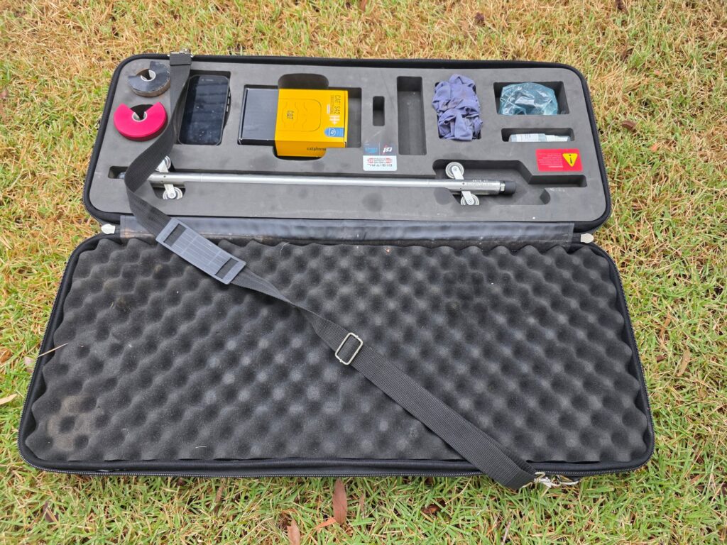
Inclinometers form part of a broader monitoring framework that may also include groundwater testing, gas monitoring and surface inspections.
It is important to note that installing inclinometers does not mean a site is unsafe. Rather, it reflects a proactive and responsible approach to asset management.
Monitoring allows Council officers to make informed decisions based on evidence, ensuring public spaces remain safe, usable and sustainable over the long-term.
By investing in monitoring systems like inclinometers, Council is taking practical steps to manage complex ground conditions today while safeguarding community assets for the future.