
A disaster can strike at any time.
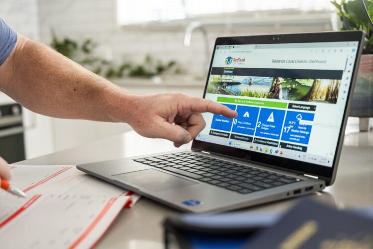
Whatever form it takes on Redlands Coast – storm, bushfire, cyclone, major water shutdown or gas leak – the Redlands Coast Disaster Dashboard is the go-to website for all public information before, during and after the event.
The Redlands Coast Disaster Dashboard is available at dashboard.redland.qld.gov.au
What is a disaster dashboard?
A disaster dashboard is a centralised, real-time online platform used by Redland City Council – and other local governments and emergency services – to provide verified emergency information and live updates to the public.
Between 25 February and 16 March 2025, as Council prepared for and responded to Tropical Cyclone Alfred, the Redlands Coast Disaster Dashboard received 429,254 total views, with 124,315 active users.
What information is available on the Redlands Coast Disaster Dashboard?
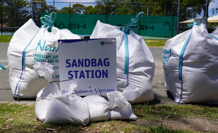
Active sandbag stations
Did you know Redland City Council operates nine permanent sandbag stations across the mainland and all the inhabited islands?
The dashboard includes a list of all locations and operating times.
During the Tropical Cyclone Alfred event, more than 155,000 sandbags and 1200 tonnes of sand were distributed to the community from eight locations.
 Flood cameras
Council has installed a network of flood cameras around the city to provide an accurate picture of the flood status at key locations:
- Pitt and Nelson Roads, Wellington Point
- Avalon Road, Sheldon
- Moores Road, Redland Bay
Images on the dashboard are updated about every 20 to 30 minutes.
Road conditions
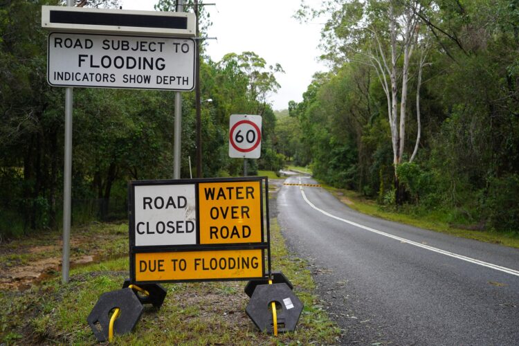
If a local road or lane is closed – whether from flooding, unsafe conditions or roadworks – it will be listed on the dashboard, identifying the street and suburb, the type of incident and impact.
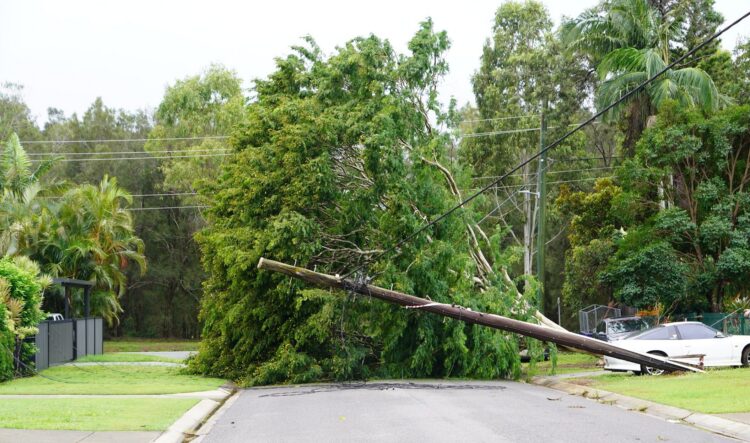
During the Tropical Cyclone Alfred event, 78 locally controlled roads were closed across the city between 7 and 10 March due to dangerous conditions such as flooding, fallen trees and fallen power lines.
Redlands Coast Alerts
This free opt-in messaging service is an important part of Council’s disaster and emergency communications.
You can sign up to receive community alerts, which are issued when there are significant impacts to the community – for example due to a water shutdown, gas leak, toxic smoke hazard, fire or details on sandbag stations and evacuation centres.
You can also register to receive flood warnings for four local roads – Allan Day Drive in Wellington Point, Avalon Road in Sheldon, Moores Road in Redland Bay, and the corner of Nelson and Pitt roads in Wellington Point.
During the Tropical Cyclone Alfred event, 119 Redlands Coast Alerts (including community alerts, closed roads and weather alerts) were prepared and distributed via text and/or email by Redland City Council; and two Emergency Alerts were prepared by Redland City Council and distributed from the State Disaster Coordination Centre.
Weather warnings
The dashboard includes information on Bureau of Meteorology (BoM) warnings – for storms and thunderstorms, severe weather, hail and marine wind warnings.
A link is provided to the BoM website, which contains a list of all warnings and alerts across Australia.
Energex power outages
Information, supplied by Energex, is available on all power outages across Redland City – including the suburb/s impacted, cause, estimated time of restoration and number of customers affected.
A link is provided to the Energex website, with further details on how to find information about your power supply.
During the Tropical Cyclone Alfred event, Energex reported more than 41,000 customers without power within Redland City – more than 9000 of these were in isolated island communities.
Fire bans and restrictions
This section links to a Queensland Fire Department page with information on fire restrictions and a link to the ‘current fire bans page’.
The dashboard also includes a Fire Danger Rating wheel for the south-east coast.
Rainfall radar
A link to a rain radar and weather map on the Bureau of Meteorology website shows rain, wind and temperature information.
Active evacuation centres
If the Local Disaster Coordination Centre needs to open evacuation centres, the addresses of the evacuation centres will be listed in this section.
During the Tropical Cyclone Alfred event, six places of refuge were opened by Council to provide shelter to community members who were unable to shelter in place safely. They were used by 47 residents.
Redland Weather Station
This section shows the latest weather observations for Redland City – including temperature, humidity, rainfall, and wind direction, speed and gusts.
The page automatically refreshes every 10 minutes.
Emergency contacts
A list of contact details is provided for:
- Emergency services
- Council-related emergencies
- Redland SES Unit
- Energex
- Telecommunications companies
- Road and traffic conditions
- Redland Hospital
- Redland Wildlife Rescue
- Emergency assistance for community recovery
- Gas leaks
Water and sewerage outages
This section includes a map and a list for water and sewerage interruptions across Redland City – whether a planned service interruption for maintenance work or an unplanned interruption caused by random events such as a burst water main.
You can even sign up to receive daily email alerts of all outages.
Disaster newsfeed
All Redland City Council media releases relevant to Disaster Management can be accessed through this section.
This includes media releases on preparing for disasters, the work of Community Champions and the Redland SES Unit, and sandbagging stations.
Local Disaster Management Plan
This plan has been prepared by Redland City Council to describe the agreed arrangements for the prevention of, preparedness for, response to, and recovery from disaster events that may impact the Redland City local government area.
The plan is a requirement under s. 57(1) of the Disaster Management Act 2003.
It includes information on the roles and responsibilities of agencies involved in disaster operations and management in the area; events that are likely to happen in the area; and strategies and priorities for disaster management.
During the Tropical Cyclone Alfred event, the Local Disaster Management Plan received 82,280 views, with 35,229 active users.
Disasters and Emergencies
These sections link to a number of valuable resources including information on:
- How to prepare for disaster
- What to do during a disaster
- Recovery after disasters.
There is also a link to YouTube videos on useful topics such as:
- Become a Community Champion on Redlands Coast
- Create a bushfire plan
- Pack an Emergency Kit
- Prepare your home for severe weather
You can also check out a list of upcoming free information sessions Redland City Council is holding to help the community prepare for extreme weather events and disasters.
Map
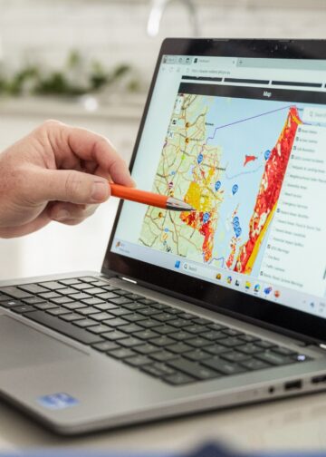
The disaster dashboard features an interactive map that can show the location of:
- Roadworks and accidents
- Queensland Fire Department warnings and fire bans
- Severe weather, flood and cyclone warnings
- Current thunderstorm risk
- Flood cameras
- Evacuation centres (when open)
- Fuel prices
Social media
The dashboard’s social media section includes Facebook and Twitter posts from Redland City Council as well as agencies with information relevant to Redland City:
- Translink – delays to bus and train services
- Bureau of Meteorology – weather forecasts
- Energex – power outages
- Queensland Fire Department – fire bans and smoke hazards
- QLD Traffic Metro – traffic and travel information for Brisbane, Redland and Ipswich areas
Other dashboards
If you are interested in sourcing accurate information regarding disasters impacting neighbouring local government areas, there is a link to the dashboards of Gold Coast, Logan and Brisbane City Councils.